Categories
Case Studies News News & Opinion Places for Everyone

£6 million street transformation complete in Greenock

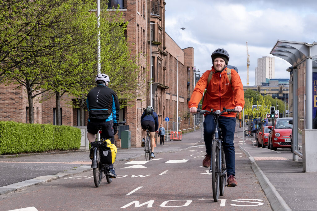
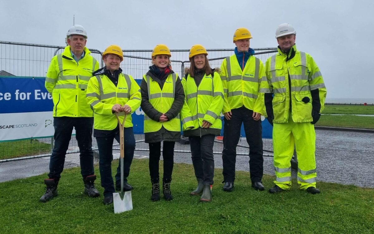
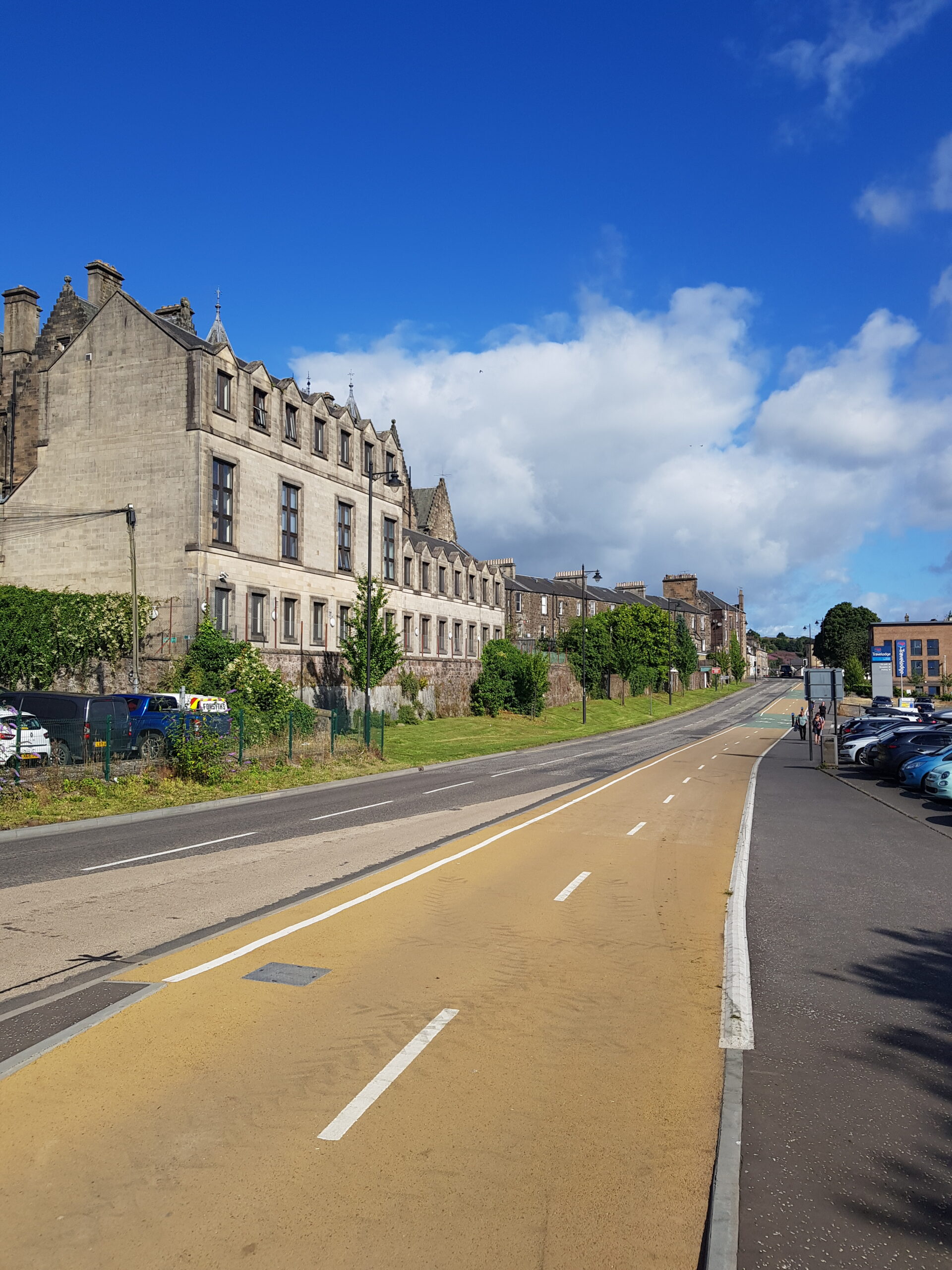
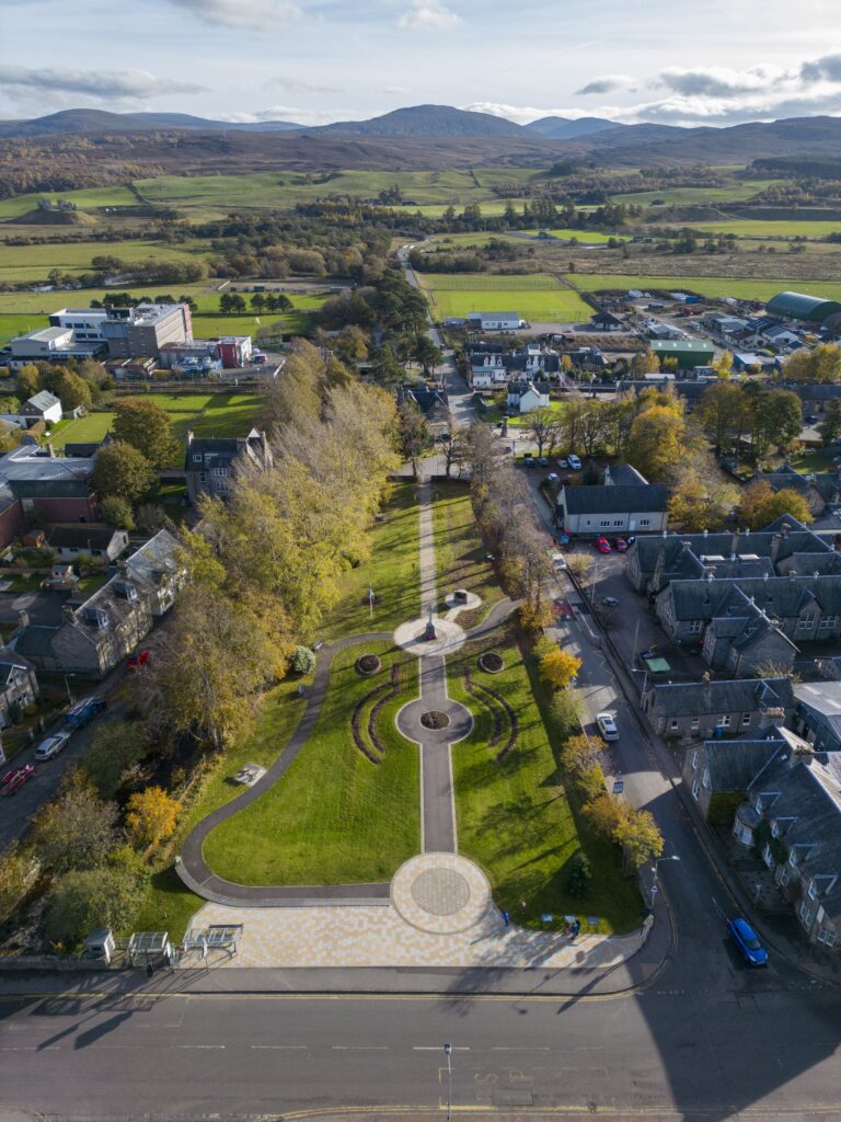
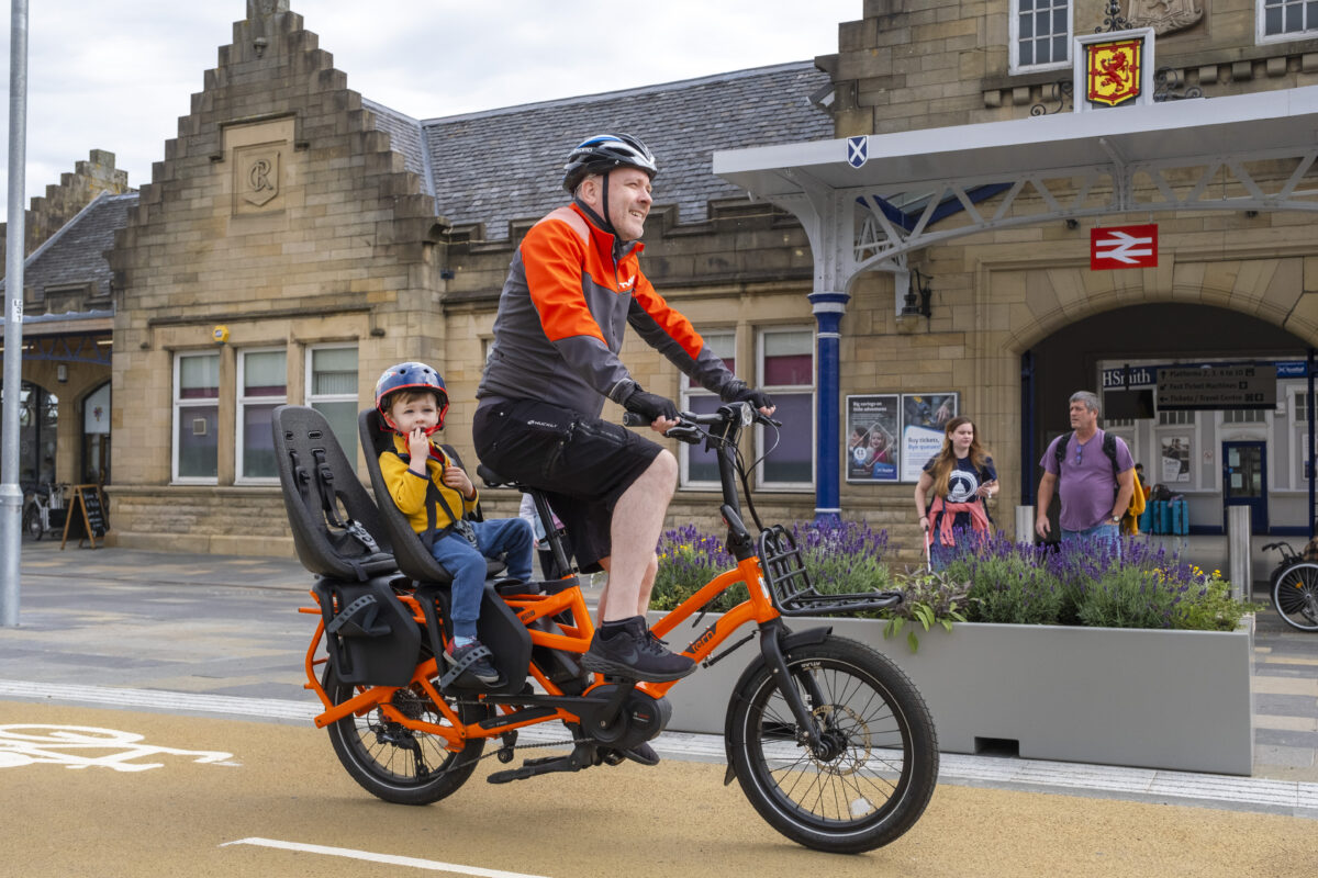
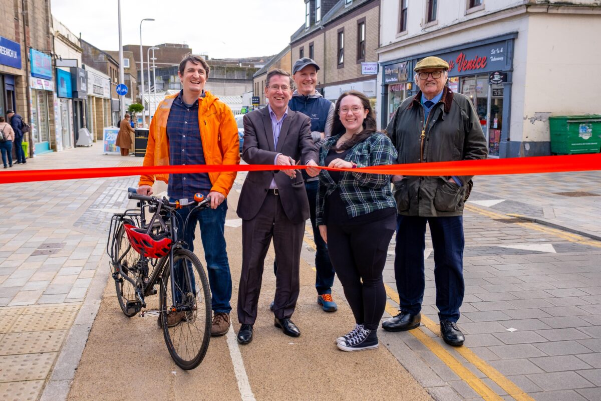
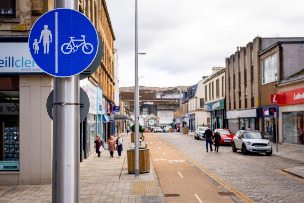
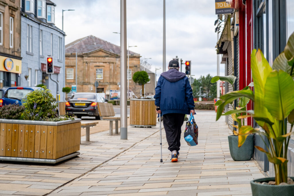
People are being encouraged to check out Greenock’s new-look West Blackhall Street following a £6 million project to improve walking, wheeling and cycling. 

The street fully reopened recently following a massive modernisation project to make the town’s traditional high street more attractive to residents, shoppers, visitors, and new and existing businesses.

The project was led by Inverclyde Council and delivered through Transport Scotland via Sustrans’ Places for Everyone programme and Strathclyde Partnership for Transport (SPT).

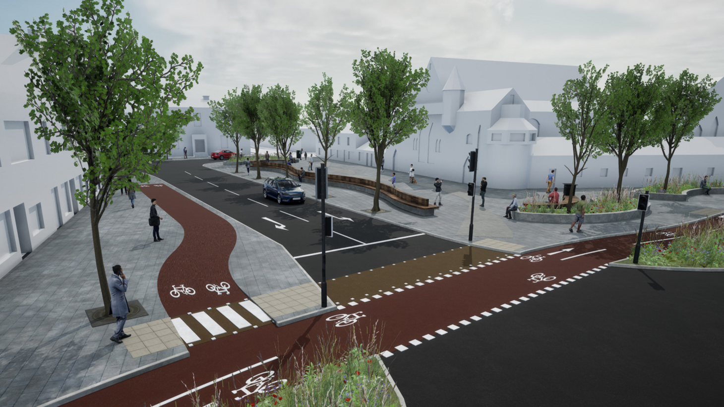
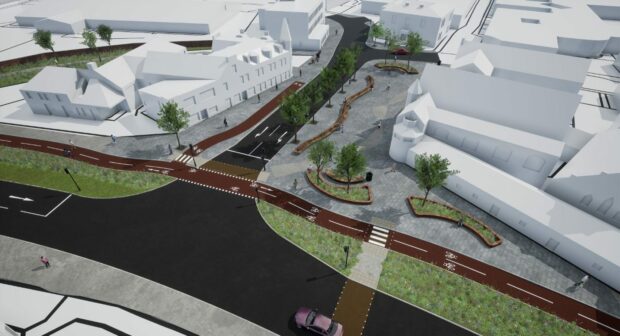
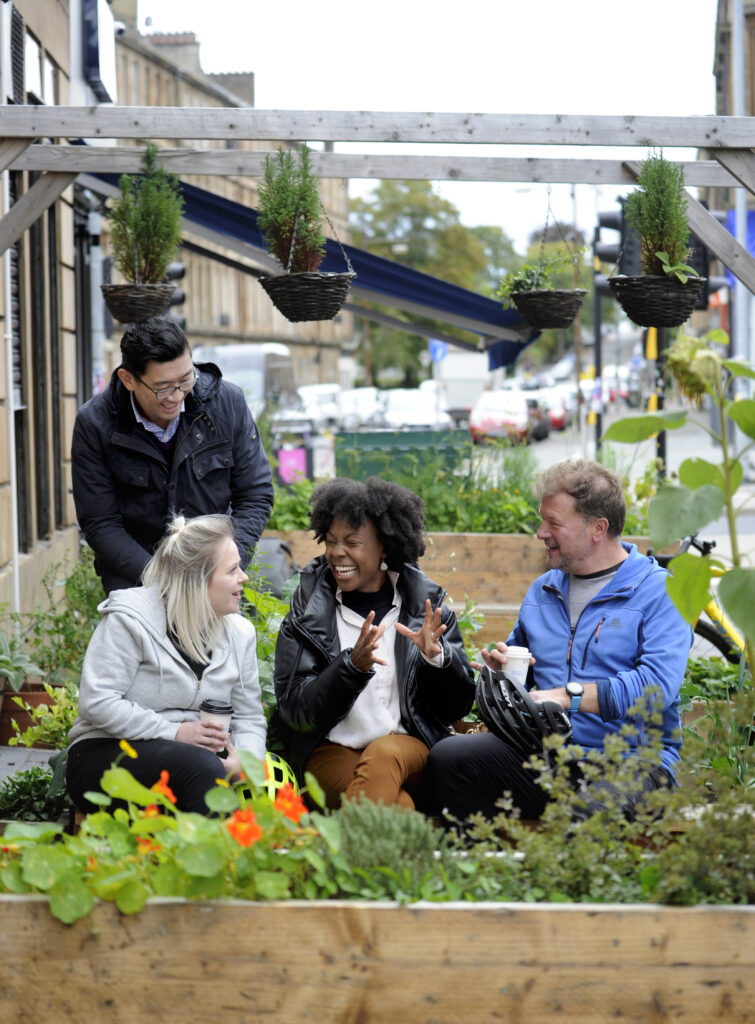
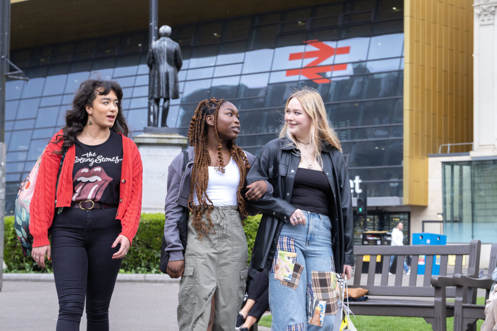
The aim of the redevelopment was to create a vibrant area which is accessible for all with additional space for pedestrians and cyclists and new public realm areas with extra seating and trees to enhance the environment, whilst maintaining vehicle access.

Work was carried out in two phases, initially starting in January 2024 and was completed last month.

Locally led solutions

The historic high street in Greenock now benefits from a new cycle line, planters, benches and more. Credit: Sustrans, 2025

Plans for West Blackhall Street were originally developed following consultations with the public, residents, traders and partners.

The project supports the aims and objectives of the Greenock Town Centre masterplan to promote West Blackhall Street as a safe, accessible and attractive street in which to live, shop and spend time in, with a focus on supporting future uses such as café culture and the night-time economy.

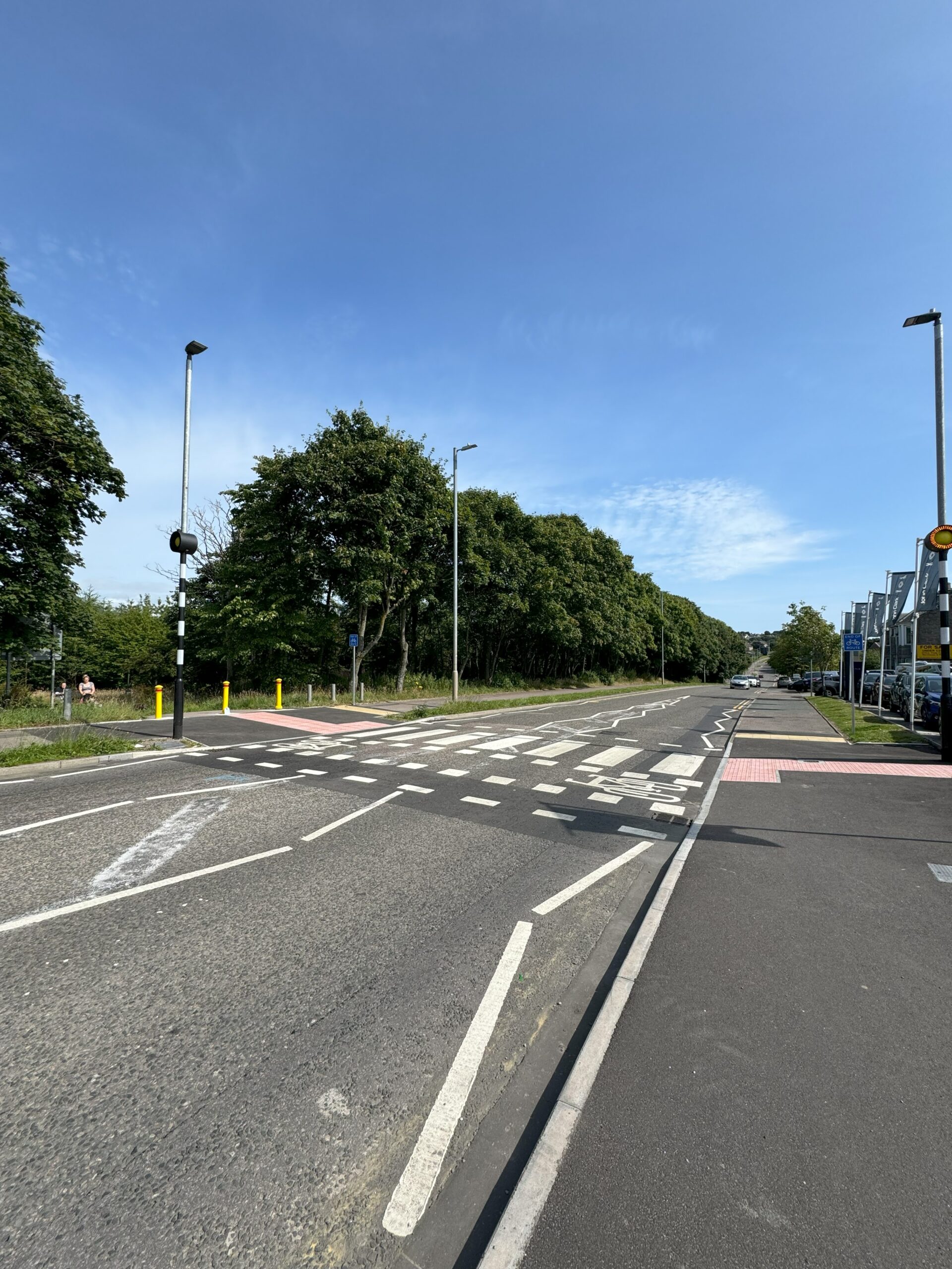
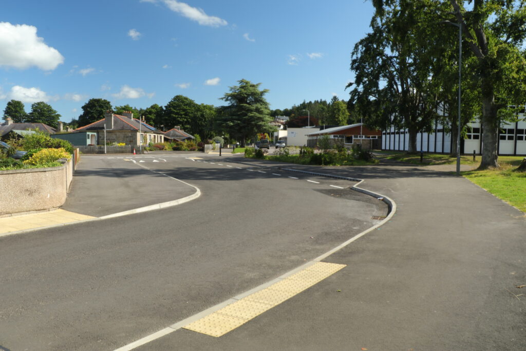
West Blackhall Street has also been opened up with existing roads layouts replaced with a single one-way system straight through from Westburn Street to Grey Place to simplify access for cars and parking down one side of the street only.

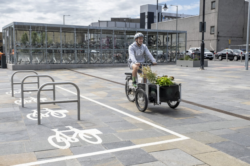
In addition to improving the look and accessibility of West Blackhall Street, the project is also designed to ‘future proof’ the area so that it will be compatible with more sustainable forms of transport and zero-carbon targets with a shift in focus towards pedestrian priority.

New and improved network

Safer crossing points and a cycle lane provision mean access to the waterfront is easier than ever. Credit: Sustrans, 2025

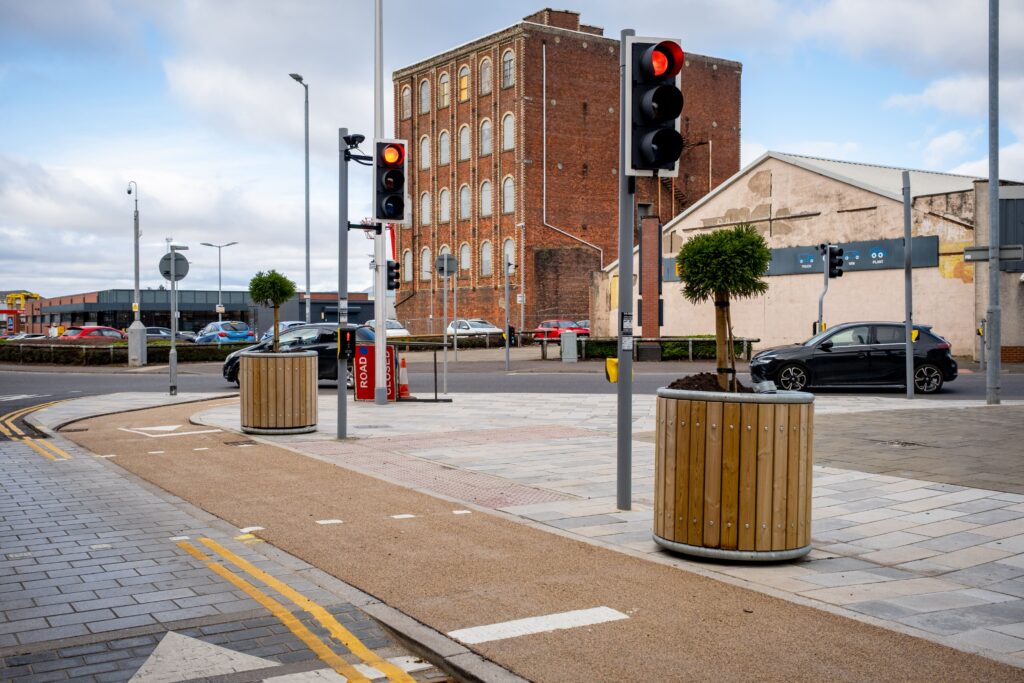
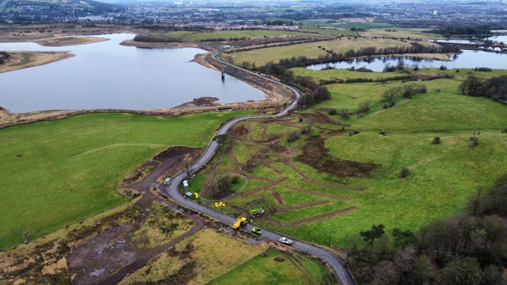
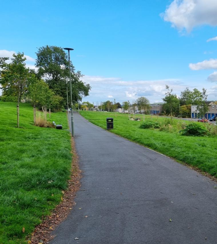
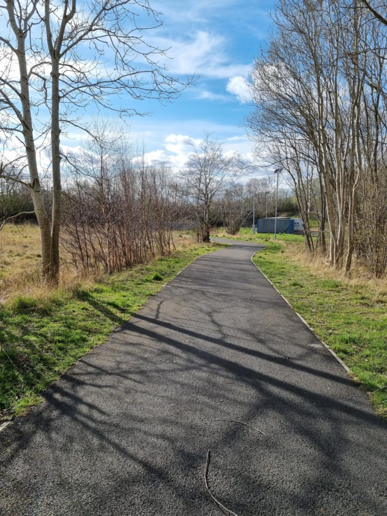
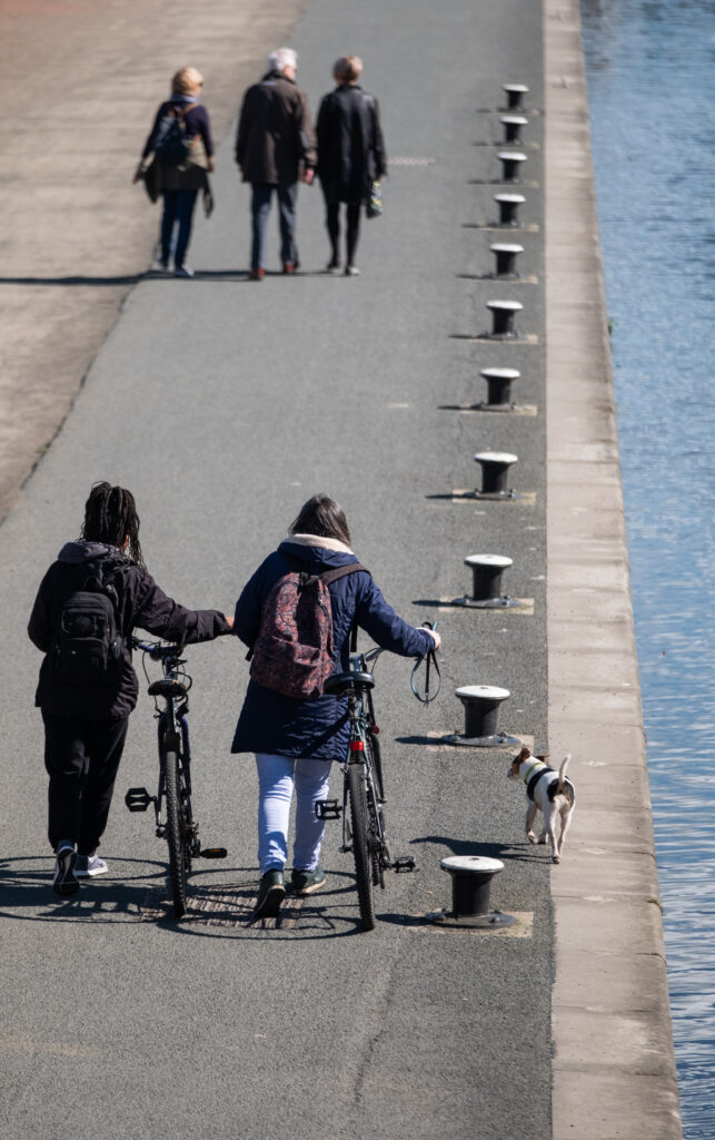
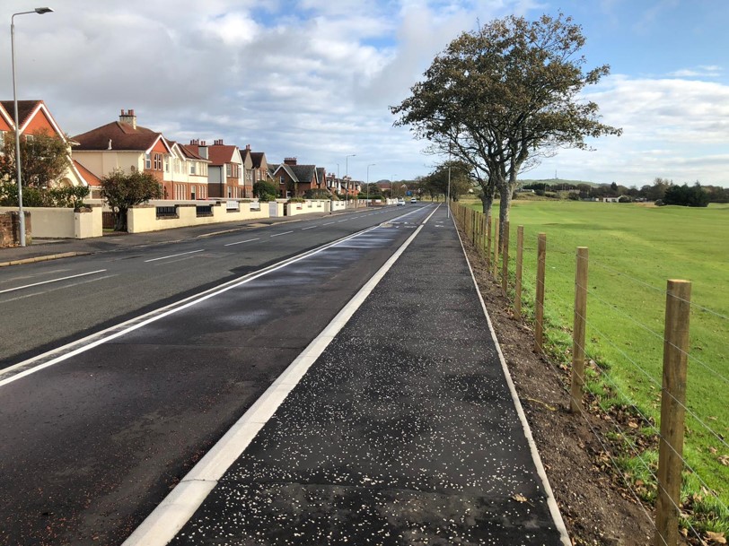
To compliment these works, a £305,000 project to improve the National Cycle Network Route 75, which links West Blackhall Street to Greenock Esplanade, and upgrade the Patrick Street junction is nearing completion.

It is being funded by the Scottish Government and delivered in partnership by Inverclyde Council and Sustrans Scotland’s Network Development programme.

The upgraded junctions at Patrick Street and Campbell Street, as well as improvements to 1.8km of the existing traffic-free Esplanade, will enable people to walk, wheel and cycle safely and easily between the newly revamped high street and the waterfront.

Delivering through partnership

It is hoped the improvements will provide an accessible and welcoming space for locals to spend their time in. Credit: Sustrans, 2025.

A large portion of the funding for the modernisation came from Sustrans Scotland through their ‘Places for Everyone’ scheme, which is an active travel infrastructure programme backed by Transport Scotland and administered by Sustrans.

Simon Strain, head of programme, Places for Everyone, at Sustrans, said:

“Making places safer and more accessible to reach and move around actively is a win-win for our communities, and we’re delighted to see these changes on West Blackhall Street which give the people of Greenock more choice for their everyday journeys.”

“As well as benefitting people’s health and wellbeing, the revitalisation of West Blackhall Street will offer a huge boost to local businesses, who can expect greater footfall as the street becomes a more attractive destination for locals and visitors alike.”

Councillor Jim Clocherty, Inverclyde Council’s vice-convener of environment and regeneration and chair of the Greenock Town Centre Regeneration Forum, said:

“It was widely acknowledged that West Blackhall Street had seen better days and the council, thanks to support from Sustrans and SPT, stepped up to try and breathe new life into Greenock’s traditional high street.”

“I’d like to thank residents, businesses, and shoppers of West Blackhall Street and surrounding areas for their patience and understanding while this important modernisation project was carried out.”

SPT provided funding towards works including upgrades to traffic lights and pavements at the Grey Place side of West Blackhall Street and to support other elements of the redevelopment.

SPT Chair of operations, Inverclyde Councillor David Wilson, said:

“This is exactly the sort of project which can make such a difference to Inverclyde, improving the area to become a become a much more pleasant place to visit and support the variety of local business available.

Categories
Case Studies News News & Opinion Places for Everyone Project/Department Filtering

£6.5m South City Way officially complete as route makes way through city centre

The final leg of the South City Way officially opened this week, ensuring more people than ever are able to safely walk, wheel and cycle to and from Glasgow city centre and along the Clyde via National Cycle Network Route 7.

The newly constructed route stretches from Queen’s Park to Trongate via a fully segregated 3km link, featuring significant improvements to junctions, pavements and street greenery.

The last section completed in June of this year allows people to safely navigate the city centre from Victoria Bridge to Trongate, a journey time of just 14 minutes by bike from the Southside to the city centre.

Opening up opportunities

The route has improved local access to businesses in the Southside and improved the feel of the area. Sustrans/McAteer, 2023.

The South City Way is already proving hugely popular, with just over 3.9 million journeys recorded along the route in the last three years, accounting for 13% of all trips undertaken along sections with new infrastructure.

Passing through Govanhill and the Gorbals, the route provides convenient access to a variety destinations on the way to the city centre, including schools, hospitals and places of worship.

Local businesses along the South City Way have also benefitted from the public space improvements.

Data collected by Sustrans’ Research and Monitoring Unit (RMU) in January of this year shows a 12% increase in retail favourability since the project was completed.

The South City Way passes by a variety of different destinations for all ages, inlcuding play parks and schools. Sustrans/McAteer, 2023.

Safety and accessibility has also been a key consideration for users along the route.

The provision of fully segregated cycleways, protected junctions, and new crossing points ensures that people of all abilities are kept safe from traffic, particularly benefitting vulnerable and less confident road users.

Health benefits are also evident in the improvements to air quality along the route.

Out latest research shows there has been a 53% decrease in carbon dioxide levels since the scheme was introduced, as well as a 75% drop in nitrogen oxides.

The most recent data collected by Sustrans on the South City Way can be accessed here.

Celebrating the city centre

People can now walk, wheel and cycle into the heart of the city centre from the Southside with ease. Sustrans/McAteer, 2023.

On Wednesday 17th July, community groups and those involved in the delivery of the South City Way project gathered at King’s Court to celebrate the route opening and for a tour of the newly completed section.

Karen McGregor, Scotland Director for Sustrans, spoke about the community benefits of the new route and the increasing appetite for safe active travel options. She said:

“The South City Way is changing people’s lives in Glasgow every day. By providing a direct and accessible route to and from the city centre, the South City Way is connecting people with schools, hospitals, and other employment opportunities.”

“With almost 50% of people Glasgow wanting to walk, wheel and cycle more, we need to deliver more segregated routes like the South City Way to link up key destinations for active travel whilst also keeping people safe and protected from traffic.”

Fiona Hyslop MSP, Cabinet Secretary for Transport, was present for a tour of the learn more about the project designs and how the South City fits into wider plans for the city. She said:

“This investment of over £3.6 million by the Scottish Government is helping us to build a more active nation, where more people choose to walk, wheel and cycle for shorter everyday journeys and can take climate action.  In doing so, we’re empowering people and with healthier and happier travel options – and building thriving communities, where businesses can flourish and everyone can enjoy improved public spaces.

“Through our continued investment in active travel, I look forward to seeing more infrastructure which is similar in the scale and success of the South City Way, in towns and cities right across Scotland.”

The bidirectional and segregated design of the route keeps people protected from traffic. Sustrans/McAteer, 2023.

Councillor Angus Millar, City Convener for Transport in Glasgow, who was also in attendance, said:

“Many people want to get about by bike and other modes of active travel but are often put off by safety concerns. It is essential we respond to the desire to travel more often by walking, wheeling and cycling by create a safer environment for this kind of transport.

“Active travel is a cleaner, cheaper and healthier form of travel that can also help to create a more efficient transport network overall. More people making better use of limited road space helps the city’s network run more efficiently and that will make it easier for everyone to get about Glasgow.”

Almost £3.8 million in funding for the South City Way was awarded through Places for Everyone, an active travel infrastructure fund backed by Transport Scotland and administered by Sustrans.  The remaining funding was supplied through Glasgow City Council.

Categories
Case Studies News News & Opinion Places for Everyone

New £18 million path opens between Broughty Ferry and Monifieth

On Monday 6th May, locals turned out in number at Castle Green in Broughty Ferry to mark the official opening of a new all-accessible walking, wheeling and cycling path along the River Tay.

Following along National Cycle Network Route 1, the £18m project sought to provide a safe and direct walking, wheeling and cycling option for residents and visitors to the area.

Now complete, the 2.5-mile long off-road path is already proving popular, with more people than ever able to leave the car at home for short, everyday journeys.

The almost £18 million funding for the project was received through Places for Everyone, an active travel infrastructure programme backed by Transport Scotland and managed by Sustrans.

Attendees at the event were greeted with refreshments and family-friendly activities throughout the day, including a bike skills track organised by Dundee and Angus Cycle Hub and dolphin spotting hosted by St Andrews University.

The ribbon cutting, heralding the official opening of the path, took place at noon and was performed by Councillor Steven Rome from Dundee City Council, followed by the unveiling of several stunning new artworks along the route.

Setting new standards

The new bidirectional cycleway is separated from the carriageway so even less confident cyclist can use it with ease. ©Sustrans/McAteer, 2023.

The tall ambitions behind the Broughty Ferry to Monifieth project were clear from the outset.

Following early consultation with residents and businesses in 2019, initial proposals sought to deliver a safe and accessible traffic-free route between the two communities.

Tying in neatly with the planned Broughty Ferry Flood Protection Scheme which was already underway, the new route would provide a direct and continuous link along the scenic coastline and enable people of all ages and abilities to travel actively every day.

Overwhelming support was received for the suggested upgrades, with over 75% of those engaged in favour of the concept designs which were presented.

Despite setbacks resulting from the COVID-19 pandemic and the rising costs of construction materials within the industry, momentum continued to build as designs progressed, demonstrating the effective partnership working of both Angus Council and Dundee City Council.

Clear demarcation of the pavement and the cycleway ensures all users are able to travel confidently and securely. ©Sustrans/McAteer, 2023.

As well as a spacious new bidirectional cycleway running for 2.5 miles between Castle Approach in Broughty Ferry and Monfieth railway station, significant public space improvements were also introduced, including additional seating, widened access barriers and improved lighting.

The communities were also closely involved in the design and delivery of a selection of stunning new artworks which complement the route.

Another major consideration from the project was in ensuring that local nature and wildlife would be preserved in abundance within the delivery of the scheme.

In order to do this, existing coastal dunes were protected within the project designs and extensive wildflower planting along the route has allowed biodiversity to continue to flourish.

One particularly significant milestone for the project was achieved in March 2024, when the new 5-metre wide Dighty Bridge was unveiled to the public.

The new accessible crossing replaces the an exceedingly narrow structure, opening up active travel to everyone and providing uninterrupted access to National Cycle Network Route 1.

An artistic achievement

Artist Fanny Lam Christie created the Tay Fins three bronze dolphin sculpture which overlook the beach. ©Dundee City Council, 2024.

Building a sense of community ownership and a sense of place was of the important importance for the project team.

This was achieved through the installation of a number of uniquely local sculptures and artworks along the route.

With seven pieces having been commissioned in total, those travelling along the path can now stop and enjoy the impressive displays whilst also learning about the surrounding area and its history.

These include a bollard trail by Tilde Arts, a poetic mural by Barry Roberston, and the Windmill Gardens by Louise Kirby which offers a quiet and tranquil space to unwind.

Most keenly anticipated, however, was the naming of the Tay Fins, designed by artist Fanny Lam Christie, depicting three breaching dolphins cast in bronze.

Following a poll of public suggestions, the names were revealed on the day of the opening – Dooker, Haar and Brochtie were chosen.

Community in focus

Following the ribbon cutting ceremony and the artwork reveals, delivery partners reflected on the project.

Lee Muir, Head of Strategic Partnerships and Business Development for Sustrans, said:

“When we make walking, wheeling and cycling easier, everyone benefits.”

“This new route between Broughty Ferry and Monifieth gives people the freedom and choice to make sustainable and active everyday journeys, reducing congestion on roads and helping to provide cleaner air for everyone.”

Lee Muir, Head of Strategic Partnerships and Business Development, Sustrans

Councillor Steven Rome, Convener of Fair Work, Economic Growth & Infrastructure, Dundee City Council, said:

“This transformational and pioneering project has opened up an impressive route for active travel between Broughty Ferry and Monifieth and will links with the route right the way through Dundee.”

“This makes the area more attractive for visitors and locals alike and the public art programme is creating a real sense of place.”

Cllr Steven Rome, Convenor of Fair Work Economic Growth & Infrastructure, Dundee City Council

Councillor Mark McDonald, Communities Convenor for Angus Council, said:

“I’m pleased to see the next phase of the active travel route connecting Broughty Ferry and Monifieth officially opened.

“The area at Castle Green is looking great and the new user-friendly and accessible pathway means more people can use it to walk and cycle for everyday journeys and for fun.”

“Thank you to everyone who contributed to achieving this milestone. I’m looking forward to seeing the work progress as it continues further into Monifieth.” 

Cllr Mark McDonald, Communities Convenor, Angus Council
Categories
Case Studies News News & Opinion Places for Everyone Project/Department Filtering

Construction starts on new multi-million pound accessible path network in Arbroath

On Wednesday 3rd April, construction officially began on the landmark Arbroath A Place for Everyone project.

The £14m project, £10.7m of which has been awarded through Sustrans Scotland’s Scottish Government-backed Places for Everyone programme, is set to deliver a transformative network of all new walking, wheeling and cycling routes throughout the town.

This aims to neatly link up key travel destinations, such as shopping areas and schools, as well as popular tourist sites.

The project will also conveniently tie with National Cycle Network Route 1, which runs along the seafront from Dundee and up to Aberdeen, further cementing links between settlements along the coast.

Backed by extensive engagement with the local community, the emerging work is expected to help foster the conditions for a significant boost to the local economy via increased footfall to businesses and an uptick in tourism to the seafront.

Once completed, it is hoped by many that the project will serve as the backbone for future active travel initiatives in the area.

History in the making

Designs for Guthrie Port include tree and wildflower planting as well as public seating areas. Angus Council ©2023

The delivery of the Arbroath project has been hotly anticipated by many for some time, with early community consultation dating back to 2015.

Financial support was initially received in 2019 via Sustrans’ Places for Everyone programme, which at the time made Arbroath the first town in Scotland to receive such a high level of funding through the Scottish government-backed scheme.

Years of careful design and planning work, informed by and acting on feedback from the local community, were then carried out between the partnership of Sustrans, Angus Council, and Arcadis.

Following this process, proposals are now being taken forward to create:

  • A new 1.5km, segregated cycleway alongside the A92 dual carriageway from the West Links area of the town to Arbroath Abbey, with a link-in to Brockthock Bridge. 
  • Redesigned junctions and crossings, making it safer and easier to walk, wheel and cycle. 
  • As well as new seating and landscapes, improving the accessibility of public spaces and encourage safer walking, wheeling and cycling options throughout the town
The junction at Brockock Bridge includes a new bidirectional cycleway with strategic crossings. Angus Council ©2023

Current traffic levels showed that large parts of the project could be achieved by repurposing parts of the A92 dual carriageway, which has long created a sense of division across Arbroath.

Working in tandem with the local community, the proposed designs were gradually enhanced, including the introduction of temporary trial measures in 2021 to help those living and working in the town get a feel for the project.

Celebrating strong partnership

Despite a persistent downpour outside the Signal Tower Museum, the first spade was determinedly dug in by Angus Council Leader Cllr Beth Whiteside.

Carole Patrick, Portfolio Director for Sustrans, was witness to the big moment.

“We’re overjoyed to see construction starting on this fantastic project. By delivering new cycle lanes, tree and wildflower planting, as well as paved seating areas in the town, people living and working in Arbroath will be able to walk, wheel and cycle safely, whilst also enjoying a more relaxed and attractive environment.”

Carole Patrick, Portfolio Director, Sustrans

Both were joined by Active Travel Spokesperson Cllr Serena Cowdy, as well as Contracts Manager for Balfour Beatty Keith McDonald and Project Manager for Balfour Beatty Tom Truesdale.

“Today’s milestone marks several years of consultation, planning and effort to create and see come to fruition, an ambitious project that will make Arbroath a more desirable place to live in, work in and to visit.”

Councillor Serena Cowdy, Active Travel Spokesperson, Angus Council

There’s a great deal to look forward to over the next year as the project truly starts to take shape, with construction the project is set to be complete by the end of 2025.


Categories
Case Studies News News & Opinion Places for Everyone Project/Department Filtering

New multi-million pound cycling route in Edinburgh city centre officially open

On Wednesday 20th March, members of the local community and key delivery partners turned out in number to commemorate the close of construction on the CCWEL project in Edinburgh.

Stretching from Roseburn to Leith Walk via Haymarket and the West End, CCWEL provides a safe and direct segregated route through the heart of the city centre, as well as significantly enhancing streets for those walking, wheeling and spending time there.

Local primary school pupils took part in a group ride from Old Colt Bridge to Haymarket to test out the route, arriving at Haymarket in time to take part in the festivities.

Music to welcome the group ride was performed by St Mary’s Music School pupils and a range of fun activities, including cargo bike trials, were on offer for all those who attended.

Shortly after lunchtime, a ribbon to mark the official opening of the route was cut to usher the new city centre route into being.

Setting the standard

Segregated cycleways, resurfaced footways, and improved crossings are key features of the new CCWEL route. City of Edinburgh Council ©2024

Following an extensive consultation process beginning in 2016, the input of residents and local businesses helped shape the designs put forward by Sustrans and Edinburgh City Council, and construction got firmly underway on CCWEL in early 2022.

With works carried out by Balfour Beatty, CCWEL has set a benchmark for how safe and accessible walking, wheeling and cycling can be delivered amongst within bustling urban centre such as Edinburgh. The first of its kind to be complete in Scotland, CCWEL delivers a 3.6km bidirectional cycle route to better connect Roseburn with Leith Walk via Haymarket and the West End.

For the vast majority of the journey, cyclists are protected from heavy traffic flows through a segregated design, meaning vulnerable and less confident cyclists will be able to use the new paths in safety and ease.

CCWEL hasn’t just delivered new routes for cyclists, however. Improved crossings, footways, and street surfacing have also been introduced as part of the scheme, as well as street greening initiatives and additional seating areas for people to relax and enjoy.

The opening comes just a day after the launch of the 2023 Walking and Cycling Index report in the capital, which includes amongst its findings that almost 50% of residents in Edinburgh want to walk, wheel and cycle more.

An historic occasion

A group ride was completed from Roseburn to Haymarket by local primary school pupils to inaugurate the new route. City of Edinburgh Council ©2024

Karen McGregor, Scotland Director for Sustrans, was delighted to see the new route completed.

“The City Centre West to East Link is an absolute game-changer within the world of active travel. For the first time ever in Scotland, we’ve delivered a fully segregated walking, wheeling and cycling connection that cuts through the heart of a major city centre. In doing so, this fantastic new route gives the people of Edinburgh a safe and accessible driving alternative, allowing people to get to where they want, how they want, regardless of age or ability.”

Karen McGregor, Scotland Director, Sustrans

Councillor Scott Arthur, who joined the group ride from Roseburn to Haymarket, said:

“Today we celebrated a major development for walking, wheeling and cycling in the Capital, with the completion of CCWEL. This major scheme is not only one of the largest pieces of active travel infrastructure delivered in Edinburgh, but it has transformed spaces along the route for the use and enjoyment of people who live, visit and work here.”

Councillor Scott Arthur, Transport and Environment Convener, City of Edinburgh Council

In total, £23m was invested in the design and construction of the CCWEL route.

Of this, £14.8m was awarded from Transport Scotland through Sustrans’ Places for Everyone programme, with the additional funding from the Scottish Government and the Council’s transport budget.

Going forward, CCWEL will link up with the George Street and First New Town and Meadows to George Street project, which aim to deliver improved walking, wheeling and cycling infrastructure across the Edinburgh city centre and enhance high-traffic public spaces for generations to come.

The project also neatly connects with the Roseburn to Union Canal project, which is set to finish construction in Summer 2024.

Categories
Case Studies News News & Opinion Places for Everyone Project/Department Filtering

Work begins to link up communities in East Renfrewshire

New year, new walking wheeling and cycling links

On 12 January 2024, a groundbreaking ceremony was held to mark the start of construction on the ambitious £22.68 million project to upgrade and improve Aurs Road in East Renfrewshire.

The project will not only create a safer, more direct local route between Barrhead and Newton Mearns by straightening out the carriageway and replacing a weak road bridge, it will also open up all new possibilities for walking, wheeling and cycling.

£8.19 million of funding provided by Places for Everyone will deliver a new 2km active travel route between the two adjacent communities, as well as an impressive 700m waterside promenade overlooking Balgray Reservoir.

As a result of the project, residents and visitors will now be able to make safer, healthier and more sustainable everyday journeys between Barrhead and Newton Mearns.

The new waterside promenade also offers the communities an accessible space to relax or meet up with friends and family.

Further plans as part of the wider Aurs Road project include a new 4km circular route around the perimeter of Balgray Reservoir, providing unprecedented access to Dams and Darnley Country Park.

Once complete, a new accessible waterside promenade will offer people a place to relax, socialise and enjoy the scenery of Balgray Reservoir. Credit: East Renfrewshire Council

Making connections outside of the city

Often, outside of our city and town centres, a lack of safe and accessible walking, wheeling and cycling infrastructure and patchy public transport links can leave communities feeling disconnected.

For households without access to a car, it also means that reaching essential, everyday destinations like their places of work, shops or health services can be difficult.

We’ve already seen the value that new walking, wheeling and cycling connections can deliver to smaller communities through Places for Everyone projects like the  completed in partnership with Scottish Borders Council in 2023.

The Balgray Active Travel Links project is another clear example of how Local Authority ambition can boost independence and choice in how communities get around, whilst also forging new links and connections.

With a combined population of almost 50,000 people, the potential impact on local travel habits throughout Barrhead and Newton Mearns can’t be overstated.

The project aims to transform journeys between Barrhead and Newton Mearns by straightening Aurs Road and building a new walking, wheeling and cycling route alongside Balgray Reservoir. Credit: East Renfrewshire Council

Partnered in community celebration

In truly frosty conditions, representatives of the project delivery teams gathered alongside Aurs Road to formally inaugurate the construction.

Karen McGregor, Scotland Director for Sustrans, shared her thoughts:

“Improving active travel links between communities outside of our cities is vital.”

“This project does exactly that by delivering an accessible and direct walking, wheeling and cycling link between Barrhead and Newton Mearns for residents and visitors alike.”

“We’re absolutely delighted to see work now starting on this project and grateful to all those who have taken part in making it a success.”

Karen McGregor, Scotland Director, Sustrans

East Renfrewshire Council Leader Owen O’Donnell added:

“Since announcing our plans for transforming Aurs Road, we’ve had a fantastic response from residents who are excited about the delivery of a much needed improved and straightened road with active travel link.”

Owen O’Donnell, Leader, East Renfrewshire Council

Signed diversion routes are in place via Stewarton Road, Nitshill Road and Darnley Road.

Funding for the wider £22.68 million Aurs Road project was received from the Glasgow City Region City Deal, made up of funding from the UK and Scottish Government and East Renfrewshire Council, the Scottish Government’s Bridge Fund, and developer contributions from new house building projects in the area.

£8.19 million was received for the Balgray Active Travel Links project through the Places for Everyone fund, which is backed by Transport Scotland and administered by Sustrans.

Categories
Case Studies News

Places for Everyone  Evidence Library

Through our Research and Monitoring Unit, we work collaboratively with partners and delivery teams across Scotland to monitor the impact of a diverse selection of Places for Everyone projects.

In doing so, we are able to gain major insights into the impacts of different active travel schemes and share our findings with Transport Scotland as well as the wider public in the form of baseline and impact reports.

Within these reports, we:  

  • Address Places for Everyone outcomes by commissioning, collecting, and analysing data on a project level.
  • Utilise standardised data collection tools to allow us to aggregate data programme-wide.
  • Write summary evaluation reports for selected projects.
  • Report on programme outcomes Scotland-wide using aggregated data and case studies from selected projects.
  • Provide guidance and training as well as support with the assessment criteria to ensure projects are impactful across the programme.

Below is a library of baseline and impact reports, all of which have been authored by our Research and Monitoring Unit.

Impact Reports

Walk, Cycle, Live Stirling Baseline Monitoring Report

Walk, Cycle, Live Stirling will build on the existing network of routes in Stirling and install new routes to create a comprehensive strategic network of high-quality cycle routes leading to the city centre. The routes will also provide better walking facilities and improved access for vulnerable users.

Photo of path with grass either side
Impact of the Cumbernauld Green Route

The Cumbernauld Green Route has shown how the resurfacing and revival of green spaces can impact the number of people walking, wheeling and cycling. Delivery for this project began in August 2020 and finished in September 2022. Monitoring shows that trips along this route have increased by 20% after project completion.

Overhead drone footage of the Bowline at Bowling Harbour
The Bowline at Bowling Harbour

The Bowline project in West Dumbartonshire has transformed the derelict Bowling Viaduct into a high-quality traffic free path with an access ramp and new linear park. Delivery for this project started in 2019 and the Bowline was officially opened in September 2021.  Monitoring shows that trips along this route have nearly doubled after project completion.

People travelling actively on Middle Meadow Walk in Edinburgh
Places for Everyone Infrastructure Impact Report 2022-23

This report presents the findings of the 2022-23 evaluation of the impact of the Places for Everyone programme, which aimed to assess the contribution of the programme to delivering Transport Scotland’s Active Travel Outcomes and a number of specific PfE outcomes. It draws on programme level monitoring data, aggregated data from a sample of infrastructure projects and five in depth case studies of completed projects.

Easy read document
Places for Everyone Infrastructure Impact Report 2022-23 (Easy Read)

This report is an easy read version of the 2022-23 Places for Everyone Infrastructure Impact Summary Report.

People travelling actively on Middle Meadow Walk in Edinburgh
Places for Everyone Infrastructure Impact Report 2021-22

This report presents the findings of the 2021-22 evaluation of the impact of the Places for Everyone programme, which aimed to assess the contribution of the programme to delivering Transport Scotland’s Active Travel Outcomes. The evaluation draws on aggregated data from a sample of 30 projects which were monitored both before and after project delivery throughout the history of the programme.

An aerial view of the completed Places for Everyone project at Gynack Gardens in Kingussie
Gynack Gardens

The Cycle Friendly Kingussie ‘Gynack Gardens’ scheme was a child-friendly project which transformed a previously under-used community space in a small rural town into a welcoming public-space and active travel link. The evaluation presents quantitative and qualitative data to evidence the scheme’s impacts, and is notable for using a creative research method (photowalk focus group) to include children’s perspectives.

Highland Cows lie on the grass beside the Lochindaal Way
Lochindaal Way

The Lochindaal Way, formally opened in October 2021, provides a safe, accessible, traffic-free route between the two communities of Port Charlotte and Bruichladdich on Islay. The full report details the results of a programme of monitoring delivered before and after the construction of the path. The summary report is also available.

A school pupil cycling along shared use path
Lower Granton Road Shared Path

Improvements were made to the path at Lower Granton Road in 2018 and the route was incorporated into the ‘QuietRoutes’ network. This report presents the results of a programme of monitoring conducted to assess the impact of the project against the Places for Everyone outcomes.

People gather together near the South City Way active travel route in Glasgow
Glasgow South City Way Protected Junctions

As part of the Glasgow South City Way project, protected junctions were installed at two locations along the Victoria Road section of the project and were the first such junctions to be trialled in Scotland. This report details the results of a study that looked at pedestrian and cyclist experiences at the junctions and how they impacted the road safety of all users.

Two cyclists take in the sea view, silhouetted against the late summer sun in Aberdeen, NCR 1
Maidencraig Active Travel Links

In 2020, Aberdeen City Council and Places for Everyone upgraded and enhanced the active travel facilities in Maidencraig, a wetland nature reserve to the west of Aberdeen. This report presents the results of a programme of monitoring conducted to assess the impact of the scheme against various outcomes.

Wishawhill Wood Path

In 2020, a muddy and overgrown track through Wishawhill Wood, North Lanarkshire, was upgraded to a wide walking, wheeling and cycling path that connects the communities of Craigneuk and Wishaw. This report details the impact of the project on local levels of physical activity, engagement with walking and cycling, and the accessibility of the path.

Baseline Reports

Commuters, recreational cyclists, pedestrians, dog walkers and water sports enthusiasts utilising the popular shared-use path alongside the Union Canal in Edinburgh. Part of National Cycle Network Route 75. This is an entirely traffic-free section of the NCN.
Roseburn to Union Canal

The Roseburn to Union Canal project aims to connect up existing active travel routes near Haymarket Station in Edinburgh and create community spaces through placemaking interventions. The project is currently under construction and this report presents the results of the baseline monitoring conducted before construction began. 

A cyclist using the Connecting Woodside route in Glasgow
Connecting Woodside

The Connecting Woodside project aims to create neighbourhood wide active travel network in the community of Woodside in Glasgow. The project is currently under construction and this report presents the results of the baseline monitoring conducted before construction began.

Cyclists travel along the Bath to Bournemouth route
Inverness Space by the Water

The Space by the Water project will improve the path surfaces and accessibility of the Caledonian Canal path network in the communities of Muirtown Basin, Merkinch and South Kessock in Inverness. The project is currently under construction and this report presents the results of the baseline monitoring conducted before construction began.

Bike Maintenance Stations at Dumfries & Galloway Royal Infirmary
Dumfries New Hospital

Dumfries & Galloway Council, with support from Sustrans, is delivering high quality active travel facilities for the new Dumfries & Galloway Royal Infirmary Hospital. A programme of monitoring will be delivered before and after construction of the infrastructure; this report details the findings at the baseline monitoring stage.

Swiss Valley Cycle Route, Celtic Trail, National Cycle Route 47
Balgray Link

The Balgray Link project aims to build a 2km long segregated cycle route connecting the communities of Barrhead and Newton Mearns and encompasses a 700m boardwalk overlooking the Balgray reservoir. This short report presents the baseline findings of a programme of monitoring delivered in 2019.

To request an alternative format for any of these reports or for any other questions, please contact monitoring@sustrans.org.uk.

Categories
Case Studies News News & Opinion Places for Everyone

The active travel network delivering for young people in Stirling

Making it easier and safer for people to travel actively is vital for increasing the number of everyday walking, wheeling, and cycling journeys.

This means ensuring that everyone, including those groups that are most vulnerable on the road, are adequately protected.

For example, children and young people.

Places for Everyone is working with partners across Scotland to ensure that the routes we deliver are accessible and intuitive for all ages and abilities.

The Walk Cycle Live Stirling project is an excellent example of how bold yet careful designs can be used to prioritise the needs of young Scots.

Routes to success

As the main connecting route between the city centre and university, Causewayhead has massively benefitted from accessible cycling infrastructure. Copyright: Sustrans, 2023.

Children and young people regularly make essential active journeys as part of their everyday lives.

From going to and from school to seeing friends and family, walking wheeling and cycling are the earliest available modes which allow children and young people to travel independently.

Currently under construction, the £9.5m Stirling project will soon deliver an extensive network of new walking, wheeling, and cycling links across the city.

This will not only facilitate more active journeys between residential areas, transport hubs, as well as retail and hospitality venues but also key destinations for education and learning.

Traffic-calming measures and landscaping improvements have made Albert Place a more welcoming and enjoyable place for all ages. Copyright: Sustrans, 2023.

Delivered in partnership with Stirling Council, Walk Cycle Live Stirling proposes to create two major routes:

Route one, dubbed the University route, will provide a safe and accessible route between Stirling Train station and the University of Stirling, taking in iconic landmarks like Old Stirling Bridge and the National Wallace Monument along the way.

Route two, the College Route, aims to bridge the gaps between Forth Valley College and the City Centre along Albert Place, Dumbarton Road and Raploch Road, passing under the impressive shadow of Stirling Castle.

The new segregated cycle lane along Dumbarton road helps keep young people safe from heavy traffic and encourages active journeys to and from Forth Valley College. Copyright: Sustrans, 2023.

Each of these strategic corridors has been designed to be largely segregated from the traffic via physical barriers, providing comfort and reassurance for all users.

Generational change

Healthier than other modes, travelling by bike is also often cheaper more affordable than public transport and private vehicle use.

Factors such as these are ones which young adults, in particular, benefit from.

Alex Avallone, a recent graduate from the University of Stirling, shared their thoughts on what the project could mean for current and prospective students in the years to come:

“I didn’t cycle when I was studying, mostly because the roads were too busy and I didn’t feel confident doing so. I took the bus or walked. Now, I hope a lot of people will think twice and choose to cycle instead”

Alex Avallone, Graduate, The University of Stirling

Katherine Henebry, Senior Grant Advisor at Sustrans, has been working on Walk Cycle Live Stirling throughout its construction, and has high hopes for its grand opening:

“After completion, children and young people can safely travel independently along two key corridors in Stirling. These routes are a new start for foundational memories to be made – on the journey to school, as well as in the broader exploration of their hometown’s rich history and environment. We’re so proud to have worked with Stirling Council to make these journeys a reality”

Katherine Henebry, Senior Grant Advisor, Sustrans

Due be complete by Summer 2024, Walk Cycle Live Stirling is set to connect communities in the city and surrounding areas through active travel in a major way. This will be particularly transformative for children and young people.

The project received £7.1m in funding from Places for Everyone, as well as £2.5m of Scottish Government investment from the City Region Deal and £258k from Stirling Council’s developer contributions allocation.

Categories
Case Studies News News & Opinion Places for Everyone

How smart infrastructure can help build a sustainable future

Increasing walking, wheeling, and cycling are all great ways improve physical and mental health.

However, active journeys are also a key part of the national response to the climate emergency, and our overall ambition to reach net zero carbon emissions.

Through Places for Everyone, Sustrans is working with partners all across Scotland to deliver safe and accessible active travel infrastructure.

This includes new connections linking up isolated rural communities as well as expansive city-wide networks to help people get where they need to go.

As part of this, we want to ensure that every one of our projects is delivered in as sustainable a way as possible to reduce our own carbon emissions.

So how can we do it?

Outlining the techniques

How we approach the design and procurement of construction materials during project delivery can have a big impact on our carbon output. 
 
When delivering infrastructure, it is helpful to think about what we can avoid, what we switch to as an alternative, and also what we can improve in the process.

What to avoid

Reducing the need for new construction can significantly increase project sustainability.

This might mean finding different ways to meet your goals without building new infrastructure at all, or by simply making the most out of what already exists through reuse or repurposing.

This approach encourages us to think creatively and sustainably to minimize new constructions. 

  • Utilising existing pathways: Before considering new constructions, explore if there are existing pathways that can be renovated or repurposed to suit the needs of the project. This might include old railway paths commonly used by the National Cycle Network, or old bridges that are no longer suitable for heavy vehicles but can carry lower loads.
  • Multi-purpose facilities: Rather than building new assets, we can design spaces that serve multiple purposes, thus reducing the overall need for new constructions.
  • Community Engagement: Engaging with the community can sometimes reveal alternatives and local insights that help in avoiding new constructions. For instance, local communities might propose efficient ways to repurpose existing assets that outsiders might not be aware of.
Forres Roysvale Park

In partnership with Moray Council, the Forres Roysvale Park project shows how excess road space can be used to implement sustainable drainage solutions. By narrowing the existing carriageway, a 3-metre-wide shared use path was introduced alongside tactical rain gardens. This not only provided a safe and direct link between Forres Academy and Applegrove primary and nearby residential areas, but also served to alleviate surface water issues. 

Where to switch

Opting for alternatives without compromising on quality can result in major savings to your carbon footprint.

This might involve changing the project scope, redesigning the approach, choosing different materials, or technologies that are more eco-friendly.

  • Sustainable Materials: Using recycled or recovered materials can significantly reduce the carbon emissions associated with the production of new materials.
  • Low Carbon Technologies: Leveraging technologies that are more energy-efficient or that have a lower environmental impact, e.g., using electric plant vehicles used in construction.
  • Nature-Based Solutions: Taking advantage of nature-based solutions, like creating green corridors which not only facilitate active travel but also enhance biodiversity.
  • Permeable pavements: Using permeable pavements can aid in water management, reducing the need for separate drainage systems.
Loans to Troon Railway

In partnership with South Ayrshire Council and Ayrshire Roads Alliance, an all-new traffic-free route to join the settlements of Loans and Troon was completed in 2023. As well as providing a key active travel link, the Loans to Troon route is notable for being constructed from almost entirely recycled paving materials. This serves to create an affordable, long-lasting but also sustainable connection between key trip generators, such as Marr College and Troon train station.

How to improve

Increasing the sustainability of the materials being used for construction can sway the carbon output of a project significantly.

This can involve thinking about the longevity and durability of the materials being used and, ultimately, planning for its reuse or recycling.

  • Circular Economy Principles: Applying circular economy principles might mean designing assets that can be easily dismantled and the materials reused or recycled, thereby reducing waste.
  • Long-life, low maintenance materials: Reducing the need to maintain and increasing time before resurfacing is needed in the future will help reducing carbon emitted during the lifetime of an asset.
  • Native landscaping: Integrate local plants alongside paths. These require less water and maintenance, sequester carbon, and enhance the appeal of the path, encouraging more use.
  • Inclusive Design and Aesthetic Design: Ensuring the pathway is accessible to people of all ages and abilities not only promotes inclusivity but also encourages more people to use the pathway, potentially reducing carbon emissions from reduced car use. Making the pathway attractive, possibly through the inclusion of art installations or well-designed green spaces, can encourage more people to use it, fostering a sense of community while also reducing carbon emissions through reduced car usage.
Roseburn to Union Canal

With the City of Edinburgh Council, work is underway to link the Union Canal with the North Edinburgh Path Network via a new traffic-free route. Inaccessible areas of decaying shrubland will be restored via tree planting and community gardens. This not only delivers a valuable connection from north to south, but also a new green corridor.

The above guidelines have been categorised according to the PAS 2080 Carbon Management in Infrastructure standard, which supports organisations wanting to lower emissions from their construction activities.

For further information, please see the Carbon Management in Buildings and Infrastructure report.

Categories
Case Studies News News & Opinion Places for Everyone

Improving active links with public transport across Scotland

Across Scotland, 29% of households don’t have access to a car. 

In our major cities, this figure rises to 46% of households in Glasgow and Dundee, and 41% in Edinburgh. 

So what can we do to give everyone in Scotland fairer choices in how they get around? And how are we supporting communities in moving towards lower carbon, healthier and happier journeys?

Convenient access to transport hubs plays a key role in how people choose to make everyday journeys. Credit: Sustrans (2023).

Increasing and improving the opportunities to walk, wheel and cycle for short, everyday journeys has a huge role to play.  

But good, reliable public transport is vital for longer journeys to work, education, everyday amenities, and friends. 

And most of these longer journeys already start and end with a walk, wheel or cycle to a stop or station.   

With Scotland aiming to reduce car kilometres travelled by 20 per cent by 2030, we take a look at some of the ways we’re better connecting walking, wheeling and cycling with public transport across Scotland and making it easier to leave the car at home.

Stirling train station transformation

The regeneration of Stirling train station is a primary example of how access to train stations can be dramatically improved for walking, wheeling, and cycling. 

More than 200 bike spaces a now available at Stirling station, including for cargo bikes and adapted cycles. Credit: Sustrans (2023).

With funding provided through Places for Everyone and working closely with ScotRail, the ambitious £5m Stirling Station Gateway project delivered a complete re-design of the station forecourt. 
 
Completed in June 2023, major changes include widened footways, comfortable seating areas, landscaping works, as well as improved signage and wayfinding points. 
 
Another key feature is the increased provision of secure covered cycle storage, offering more than 140 additional cycle parking spaces and increasing the total number of cycle spaces at the station to more than 200. 
 
A large portion of the space required for these improvements was been created via changes to the carriageway and the reallocation of the taxi rank to an adjacent street. 
 
Importantly, access for blue badge holders has been entirely retained at the station, with additional spaces even being provided.  
 
Perhaps one of the biggest successes of the project, however, is how well it interconnects with the wider Walk Cycle Live Stirling project via segregated cycleways along Gooscroft Road. 
 
Delivered in partnership with Stirling Council via Places for Everyone, Walk Cycle Live Stirling aims to deliver a £9.5m city-wide active travel network. 
 
Taken together, all this has helped transform the area from an unappealing vehicle-dominated environment to one which creates space for safer, and more accessible active travel options.

Bike spaces on Borders buses

Bike storage on the X62 service, serving the Tweed Valley and Scottish Borders.

The work which Sustrans delivered with Borders Buses highlights how public transport can assist cyclists in making longer journeys without having to leave the bike behind.

With the novel creation of bike storage spaces on board, the X62 service, which serves Tweed Valley and the Scottish Borders, was able to become a fully bike-friendly route.

This involved retrofitting bike storage onto buses so that every bus operating on the X62 route would have space for a minimum of two bikes.

It also involved a change in livery, marketing and promotional materials with the aim to increase the catchment area of the bus service.

The money Sustrans provided resulted in a fully bike-friendly bus service that runs from Edinburgh to the Scottish Borders. By making buses bike-friendly, they become accessible to more people.