Grab a cuppa, get comfortable and join us for some informal constructive conversations about some of the challenges in delivering active travel infrastructure.
This series of constructive conversations will explore how some of the big issues facing society today can be addressed ‘By Design’.
At each 1 hour session, our expert panel spent half an hour discussing key questions and more around these topics. Following this, participants were invited to take part in optional small group discussions where they could share their own experiences on the topic, present a related issue in a live project, and receive advice and feedback from peers.
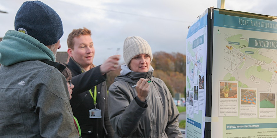
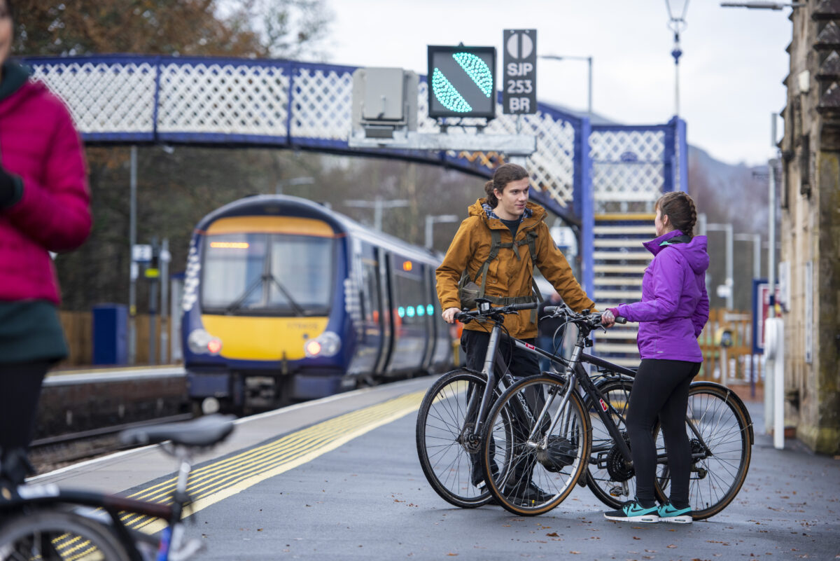
John Linton/Sustrans. E-Bike and Brompton. Pitlochry Train Station, Route 7.
Overview
We invited Places for Everyone partners to join us for this webinar, as part of the Places for Everyone training and events programme – Engage · Inspire · Learn.
The session introduced the Sustainable Travel to Stations Strategy (STSS) – Scotland’s Railway’s strategic plan to help make it easy, convenient, and safe for most passengers to get to and from railway stations without a car.
The vision of the STSS is to grow the number of journeys passengers make to, and from, local neighbourhoods to the railway station by healthy and sustainable modes of transport: walking, wheeling, cycling, on-demand transport, and the bus.
The need for close collaboration and co-creation between all stakeholders to integrate stations is pressing. This strategy sets out to propose a tighter alignment between planning and delivery at all levels.
Presented by John Lauder, Deputy CEO Sustrans on secondment to Scotland’s Railway, who is leading on the strategy, the webinar covered why the strategy has been developed, how it is being delivered and what that means for you.
Q:If I was to draw a 5km radius ‘as the crow flies’ around a railway station, a bike journey would likely take longer than that 5km journey. Do you have an idea of how much longer you would expect for that journey to be done by bicycle?
The 5km outlined is based on the active travel framework and the target utility cycle journey in Scotland is 4km, so we’ve extended that to 5km. But it’s a rule of thumb that I would expect local authority officers to adapt based on topography, density of housing, and other factors. By and large, that’s the approach we want to see upheld.
It’s all about context and that’s where the Local Authority, RTP and Rail need to work together. Let’s start thinking about how stations work for the wider community – let’s go beyond thinking about the immediate car park.
Q: What are the suite of pilot projects, and how have they been selected?
We don’t have a fixed suite of pilot projects yet. We are currently talking with a couple of local authorities and want to get those up and running as practical pilots. Now we also have projects which are very close to the point where they could go for funding applications. So we currently have projects in delivery, in development and in discussion.
If you have a project that you are enthused about, we would like to hear from you. When my secondment ends, a new email address will become available to send your ideas about station integration to, and this will go directly to the Strategy and Investment team. A Practitioners guide will also be released in the next few weeks.
Q: Does the strategy consider accessibility? For example, how do things like access to benches and toilets, that are necessary for some people to make that journey, fit into the strategy?
Our accessibility strategy which is coming out shortly, will cover that exactly – for example seats, signage, toilets, noise colours, surfaces, step-free access. The challenge is that a lot of stations are old and can be difficult to access. So there’s a lot to be done here. Part of the challenge will be prioritisation. The accessibility strategy will say that we need to up our game and improve our stations.
Q: What do you know about the people who travel by train and don’t fill out the survey? It seems Rail doesn’t know its passengers well enough.
There is a lot of work needed because Rail don’t know enough about how people use their services. This survey is basic, empirical data and we need much more informed data. The Passenger Experience team in Scotrail are beginning to do some work around profiling, and understanding the needs of their users better, but there is a lot of work to be done to get more meaningful conversations with passengers.
Q: How do you envisage the 5km “zone” being applied in a rural context, for example Aviemore or Pitlochry?
I would like to think that we can do more to have better services to stations by either bus or community owned transport where distances are big. So for example, Stonehaven station, the radius here for the travel to station distance is 40km. What can we do there to give people an option not to use their car?
To answer the question about Aviemore and Pitlochry, I would like to see better facilities for walking and cycling, better cycle storage, a better accommodation of electric bikes that type of thing there. The strategy is quite clear that there will be an element of parking requirement in rural areas. But there’s an issue there, about how rural areas currently provide some form of public transport or not, and how that can be tackled over the next few years.
Q: Will Scotland’s Railway work with Network Rail if there is a network rail bridge in the 5km radius which is a serious barrier to those cycling and wheeling (due to steps)?
I would very much hope that with the endorsement behind this strategy, the property team and also the asset protection team (who look at every proposal in and around the real estate and how will it impact on the safety of the estate) will look positively on this type of application. A barrier like this, making it difficult to get to the station, might just discourage people from taking the train. So this definitely needs to be tackled, and again, it’s why we’re saying we want Rail to think about 5km from the front door and we want local authorities to think about the station 5km from a development.
Q: Beyond the pilot projects, will there be yearly funding available for local authorities to apply for access to stations?
My understanding is that Transport Scotland will encourage projects being submitted to them that are transport integration projects, particularly station integration projects. I don’t think there’ll be a dedicated fund created. I think the expectation that this is a theme that will grow and develop over the next few years and we’ll see more applications coming in.
Q: For many people in a rural environment, it will be a 3-5km journey to the station and also on the other end. Can you say anything about the lack of capacity of bike storage on trains?
The positive is that ScotRail are currently consulting on a whole new fleet of trains and this decarbonisation programme is leading to a complete refresh of the entire rolling stock. So there’s an opportunity to see an emphasis given to much greater provision of cycle carriage that will be part of the tender that’s released.
Speaking from experience, my concern is the ability of Rail to be able to cope with demand because I think demand’s going to grow and grow to have carriage of cycles and trains. So that also questions the availability of good cycle parking, but also the availability of cycle hire at the other end as well. But this consultation on a new fleet gives us an opportunity for better provision for those using wheelchairs and mobility aids and those with a lot of luggage.
Q: Is there anything we can do in terms of phasing new stations,or improvements of stations, and integrating them around new developments?
There has to be much better provision, right from the start, that you can walk and cycle and get a bus in and out of the station. And it’s why I’ve highlighted the need for housing developers to begin thinking about how the housing development is designed around the station, so that it’s easy to get to the station from the get go. If we were following the infrastructure first planning principle, we would have the paths to the station long before housing is built. And that’s really what is needed.
Q: The West Coast trainline has dedicated bike carriages, which is great to see. Are there proposals to have similar facilities on wider networks or routes to make it more user friendly to get more cycles and wheeled vehicles onto trains?
I’m not aware of it, but as I said, the whole rolling stock for passenger services is to be refreshed, and it’s an opportunity to influence the decisions that are taken by ScotRail and the purchase of those trains. I would encourage you to participate in that wider consultation when it’s launched later on this year.
Q: John, do you have any key takeaways you’d like to share with the audience today?
This is a brilliant opportunity to think about the stations in your area and how easy they are to get to on foot by bike, wheeling and by bus. And it’s a golden opportunity to go to Rail and say we really want to improve this – how about it?
Because this strategy has been endorsed at the highest level, and we know more funding is becoming available for active travel, this is a great time to come up with a proposal to do something we’ve all wanted to do for a long time.
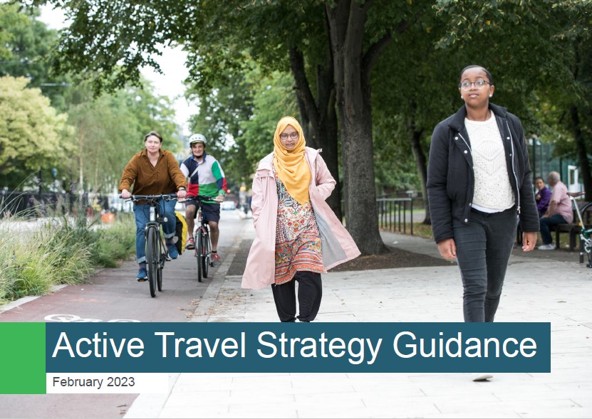
We looked at the key changes with the previous 2014 guidance, and it was put into the context of Transport Scotland’s Cycling Framework, which highlights the need for Active Travel Strategies in setting out partners’ approaches to enable active travel.
Stuart Logan from Transport Scotland kicked off the session setting the scene with National Policy Content. We then heard from Matt Davis from Sustrans who gave us an overview of the guidance document and highlighted key changes.
Following this, other members of the Steering Group who oversaw the development of the document, joined us for a panel discussion and Q&A, including:
Anna Gale, Public Health Scotland
Rona Gibb, Paths for All
Gail MacFarlane, SCOTS and West Dunbartonshire Council
Session recording
An Introduction to Active Travel Strategy Guidance
Questions & Answers
Q: I would like to know more about what the challenges/developments are for rural Active Travel Strategies or rural linking into and out of urban areas.
Each local authority should look at the key challenges in their area and work with the stakeholders in their area to develop their strategy.
There are lots of discussions going on just now about about 20-Minute Neighbourhoods and the links between rural and urban communities, and it’s all part of a wider package that we must be thinking about about how we connect these. There are also discussions about how 20-Minute Neighbourhoods might work within a rural setting and an urban setting, and these are very different things.
Q: Were interventions like Road User Charging considered as part of this work?
This is a broader transport intervention that would be covered in local transport strategy, and authorities will need to have a local transport strategy before they can implement things like this.
This guidance aims to support colleagues deliver active travel strategies. Road user charging is more around a ministerial/governmental policy. There wouldn’t be a huge impact of road charging on active travel initially because if it’s brought in, it would be trialed on major trunk roads, which are not the kind of roads we’d be looking to implement active travel interventions.
Q: Is there a call in the guidance to work regionally towards certain outcomes, and if not, is this something that is recommended?
There is an opportunity to work regionally here. Be it logos on signage for example. Discussions around cross-boundary and inter-regional work would certainly make it a more comprehensive system for public use. It comes with difficulties just now in terms of how the structure of funding and other things come in.
TS has increased funding available to Regional Transport Partners and RTPs should be looking at that regional overview. Cross-boundary is becoming more of a focus as TS look to increase funding.
Q: Is there an issue with the long term maintenance of active travel infrastructure that is being created?
As we know, every local authority budget is stretched. Road Asset Management Plans set out key priorities for the year ahead and how funding, revenue and capital are allocated. As we develop the strategy that shapes where that money is allocated, we are now looking at how we maintain active travel infrastructure. It’s challenging because people tend to report potholes rather than damage to a cycle lane. Our inspection regime needs to reflect that; ensuring checks are in place and feeding into the prioritisation of spend.
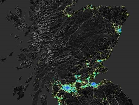
This online session introduced the Network Planning Tool, which predicts the relative demand for cycling on the majority of streets and paths across Scotland.
The tool will provide a national and objective evidence base, which Places for Everyone partners will be encouraged to use, to help identify and prioritise infrastructure proposals in their Active Travel Strategy. Ahead of the completion of the tool, scheduled for the end of 2023, a prototype was released to partners in April.
This session covered:
why the tool is being developed
how it works
how the prototype compares to the complete tool
how it is envisaged the tool will be used by Sustrans and partners.
Session recordings
In the first recording below, we hear from:
Simon Strain, Head of Programme (Grants) at Places for Everyone;
Matt Davis, Principal Mobility Planner at Sustrans Scotland; and
Robin Lovelace, Associate Professor of Transport Data Science at the University of Leeds, and one of the developers of the tool.
In this second recording, we hear from Russell Pepper, a Sustrans Senior Project Officer embedded in Dundee City Council. Russell talks about his experiences of using the tool alongside the Council’s Cycling Strategy.
Questions and answers
Q: Can the tool accept data from Local Authorities and other partners to make it more accurate at a local level?
Great question. No, the tool only takes input datasets that are available for all of Scotland currently. We may in future versions allow locally specific input datasets but that is not in the near-term roadmap. You will be able to download datasets to compare with locally specific datasets such as new housing developments, planned interventions, however. Which local input datasets were you thinking of Vikki?
Q: Will the Network Planning Tool be integrated into any of the Regional Transport Models?
We do not control regional transport models so this is not within our gift. However, we are open to conversations about sharing NPT outputs to feed in, or using outputs from other models to feed into the NPT although we will prioritise national and open input datasets.
Q: How can we ensure that rural areas that don’t necessarily have as much demand as cities, can still get funding for these important corridors?
The addition of other trip purposes (e.g. school) will help with that. The Phase 2 option of adding public transport integration and showing the cycling components of longer mutli-modal journeys will help in the longer term.
Q: How effective is the tool in less urban areas? (, Argyll and Bute Council)
This early prototype version of the tool is less effective in rural areas as it’s based on commute data, which accounts for a disproportionately low share of cycling trips in rural areas. This will be addressed as we add more trip purposes in future versions. School and other everyday journey purposes will be included in the release of the tool at the end of 2023. In the future there is the possibility to include leisure/recreational journeys as well as the cycling component of longer multi-modal journeys, which will further increase the effectiveness in rural areas.
Q: How will tool take account of increase of e-bikes? As distance and especially hills become less relevant to e-bike riders.
We will include an E-bike scenario and E-bike specific routing options.
Q: How does the tool deal with identifying origins and destinations in rural areas where most data zones are quite large?
The tool uses a Jittering method to disaggregate flows in large data zones. Currently we’re using Output Areas for subpoints but we can use other subpoints for origins and destinations. Any suggested datasets for origins and destinations in rural areas? See here for an overview of the Jittering approach used: https://findingspress.org/article/33873-jittering-a-computat…
In future versions we will use smaller zones as the basis of the commuting origin-destination data and we have commissioned this data from NRS. This will be completed for inclusion in the release at the end of 2023.
Q: The test version of the NPT doesn’t appear to show any cycle data in many rural areas and islands. I understand some locations may not show potential for many cyclists but nothing is shown for Cycle Friendliness or Gradient either, can this be shown for all roads/routes irrespective of use forecasts?
As per the ‘effectiveness of the tool in rural areas question’, the current lack of cycle data in many rural areas and islands is expected to be addressed by inclusion of additional trip purposes into the tool.
In terms of not showing cycle friendliness or gradient where there are no forecast trips, there are several practical reasons why this is done. Firstly the cycle friendliness and gradient are generated at the routing stage. So, any road with no cycle demand in our model has no data to visualise. To infill these missing roads, we would have to create additional routes to fill in the gaps. This would require an enormous amount of additional routing, and it would undermine our goal of updating the tool on a monthly basis. Secondly, by only showing data for roads that have some cycle demand we significantly reduce the volume of data that is stored on the server and sent to the user’s device. Including data for every road in Scotland would increase the data requirements by about an order of magnitude. This would significantly reduce the performance of the tool and increase the cost of web hosting.
However, some of the missing roads will be added as we add different journey purposes. Experience from England, Wales, and the Republic of Ireland show that the non-commute purposes produce very different networks. So, it is likely that this will also be true in Scotland.
One thing to note is that when viewing the cycle friendliness or gradient maps the choice of network type matters. For example, a busy road with no cycling demand under the “quietest” type will not show a gradient of cycle friendliness even if the data is available. You can check for this by switching between the different network types. This is an aesthetic choice we made to make the network confident with the number of cyclists view. But we would welcome your feedback.
Q: Will cycle tourism data be a filter options in later versions?
Including recreational cycling as a journey purpose is under consideration for development during 2024 .
Q: Can you export maps and GIS file formats from the online platform?
Not currently, but we plan to add this functionality when we publish v0.2, which will include travel to school potential in a combined network.
Q: Is the ‘number of cyclist’ filter ‘per day’?
Yes, this corresponds to the number of cyclists on a typical day. We will shift to AADT (annualised daily traffic) estimates for the final version.
Q: What data/information is used to determine cycle friendliness i.e. hostile or quiet, how up to date is this?
Q: Rural recreational cycling is also an economic growth opportunity. Will this be considered more going forwards?
Yes, there’s potential to include this in phase 2.
Q: How can you ensure that the Go Dutch model is accurate if the data used is 12 years old? Can you provide a link to the methodology for this model, please?
The current prototype does use 2011 census commuting data. This will produce networks which emphasise arterial routes to major employment centres. The current distribution of residential and major employment sites is likely to have many similarities to that in 2011, so we expect the results to be broadly applicable to the current picture. We are also updating the commuting layer prior to the end of 2023 to take account of recent population growth estimates. However, once the 2022 Census journey to work results are released, we plan to update this layer.
In addition, prior to the end of 2023 release we will also include travel to school and other everyday trips which will have different source data and baselines. For example the travel to school data was collected in September 2022, so the baseline for the Go Dutch Travel to School layer will be more recent.
This information will also be included in the Network Planning Tool manual prior to release at the end of 2023.
Q: How is the baseline data calculated and how often is the website kept up to date?
The current prototype baseline data is from the 2011 census for journey to work. We plan to update with the 2022 census data when this becomes available. The website is currently kept up to date on a monthly basis.
Q: What is the network based on? I looked up Inverness. It did not show remote paths / routes for example locks are used to cross the canal. This means that a busy active travel route is not showing up on the tool.
The current prototype only includes commuter flows so routes that are heavily used by other trip purposes (such as shopping, recreation, school travel) will not show up. We will be adding more trip purposed before the full launch at the end of the year. Also by default the tool shows the fastest routes, these may be on very busy roads that in reality cyclists avoid. We do this to highlight places that cyclists may wish to cycle, but can’t due to a lack of suitable infrastructure. Finally our routes are calculated by cyclestreets which is in turn based on the OpenStreetMap (OSM). It is possible that an error in the OSM (e.g. a missing path link) is preventing routing in this area. So we suggest checking planning a cycle route on the cyclestreets website, in the immediate area where this issue occurs. This should identify if cyclestreets is picking up the path(s) in question, as part of cycle route planning. If an error is identified it is possible to edit paths in OSM, which may fix this problem.
Q: Are there any plans to link this tool with existing cycle counter data?
Cycle count data will be one of the data sources used to validate the tool’s outputs prior to release at the end of 2023.
Q: Is there more info on how cycle friendliness is calculated, that can be put on the system in the help section?
Q: Are there any plans to develop a layer to map existing cycle use-age / counts to assist in validating the tool? Strava heat maps are only partial data but can be an eye opener on what is actually being used
We are not currently planning to add visualisations of cycle count data into the tool. Cycling Scotland have an open data platform that displays Scotland-wide cycle count data. However, we are planning to use this cycle counter data to validate the tool’s outputs prior to release at the end of 2023. Strava data has a bias towards leisure & recreation journeys so we are not currently planning to use this in validation. However predictions of leisure & recreational journeys are being considered as a function to add to the tool during 2024. If so Strava data will be one data source that is likely to be used to build this function.